

HISTORICAL GEOGRAPHY CURRICULUM MODULE

USING GEOSPATIAL TECHNOLOGY TO UNDERSTAND HISTORY
BIG QUESTIONS
- How can geospatial technologies impact our view of the world, in past and present, and help us predict the future?
- How can geographic tools help us understand the importance of geography on our understanding of history?
OVERVIEW
In schools, the social sciences (social studies) may be presented and understood as discrete disciplines, with courses focusing on geography, government, economics, and history each independent from one another. Furthermore, the methods used to understand one discipline may not be considered in others. For example, history is often presented as static. It may be seen as some “thing” (event, person, etc.) that happened long ago, has been reported in a textbook, and is unchanging. However, it is important for learners to understand that new evidence can have an impact on our understanding of the past, and that evidence may come from unexpected places. As new technologies emerge, there are increasingly new methods available supporting investigations attempting to understand our world, present and past. Focusing on the development of students’ abilities to “Explain the advantages of using multiple geographic representations to answer geographic questions” (NRC 2006) within the context of history, this module challenges students to use information presented through historical and topographical maps, panoramic views, remotely sensed images, geographic visualizations, and computer generated recreations to address the essential question: How can geospatial technologies impact our view of the world, in the past and present, and help us to predict the future? Supporting this question, students will consider how geographic tools can help us to “re-see” historical events.
Content focus:History, geography,social studies
Skill focus:Map interpretation, remote sensing, data analysis
Level of Inquiry: 2- Structured inquiry.
Key Concepts: Perspective (historic and geographic), representations, viewshed analysis, “re-seeing”
Grade Level: 9-12
Duration: 1-3 days
List of Student Resources (Worksheets) by Section:
Engage-Student Resources I & II
Explore-Student Resources III & IV; Appendices A & B
Explain-Student Resources V & VI; access to Internet for video & maps
Apply-Student Resource VII; Appendix C
Connect-Access to Internet for Videos
Extend-None
Standards
National Geography FOCUS STANDARDS
Properties of Geographic Representations (end of Grade 12)
-
- Explain the advantages of using multiple geographic representations to answer geographic questions, as exemplified by being able to
- Explain how multiple geographic representations and geospatial technologies (e.g., GIS, GPS, RS, and geographic visualization) could be used to solve geographic problems (e.g., help determine where to locate a new playground, or identify dangerous street intersections within a community).
C3 Standards
PRIOR STANDARD
ANTICIPATED PRIOR KNOWLEDGE
National Geography Properties of Geographic Representations (end of grade 8) Student knows and understands: The advantages and disadvantages of using different
geographic representations—such as maps, globes, graphs, diagrams, aerial and other
photographs, remotely sensed images, and geographic visualizations for analyzing spatial
distributions and patterns.
ANALYZE AND EXPLAIN BOTH THE PROPERTIES AND FUNCTIONS OF:
-
- position and orientation
- projections
- symbols
- scale
- perspective
- coordinate systems
Analyze geographic representations based on their properties (e.g., orientation, grid system, scale, resolution, and content)and purposes (e.g., using GIS and digital globes to explore geographic information and relationships at a range of scales).
C3 Standards
LEARNING TARGETS
By the end of this module students will appreciate how geographic thinking and tools can provide perspective to help us understand historical events. They will use spatial thinking and geographic tools to make predictions and suggest solutions.
Using GST to Understand History: Viewshed Analysis & “Re-Seeing” Gettysburg
CONTENT BACKGROUND
Teachers wishing to provide extensive background on the Battle of Gettysburg may use their textbooks or resources found at the end of this lesson (Appendix A).
Overview: The Battle of Gettysburg is considered one of the most important battles of the American Civil War and came to be known as the turning point in the conflict. It was here that Confederate General Robert E. Lee marched his Army of Northern Virginia into Pennsylvania, meeting the Union Army of the Potomac under the leadership of General George G. Meade, at Gettysburg. The battle represents the bloodiest of the Civil War, with over 50,000 causalities over the course of the three-day battle. It is also one of a few battles taking place on Union soil. The decisions made by both sides were in part predicated on their understanding of the geography and the information available to them at the time.
ENGAGE |
|
|

As students read the following diary entry by Henry Keiser, of the 96th Pennsylvania Regiment Resource link -Click HERE direct them to identify words and phrases describing the place (or places) this diary is describing. Students are to be prepared to defend claims related to language they have identified. Teachers may want to remove direct references to the location including Little Round Top, and Gettysburg, as illustrated in selection below using to promote students’ use of context clues (Student Resource I).
Henry Keiser, of the 96th Pennsylvania Regiment Diary Entry - July 2, 1863
Instead of turning to the left last night, we should have turned to the right, and by the time we were fairly started on the right road, it was daylight. At 8:30 this morning we crossed the line into Pennsylvania, and at 10 A.M. we passed through Littlestown. The civilians along the line of march could not do enough for us. Most every household standing ready with water buckets dealing out water to the boys as we marched along, and the Stars and Stripes hanging out in all directions. It made us feel as if we were home once more, and the citizens of Southern Pennsylvania, through their kindness to the soldiers have put now life into us.
Can hear heavy canonading ahead all day. At five O'clock this evening we arrived at what is called Little Round Top, a short distance from Gettysburg. Very heavy firing to our left at 5 o'clock.
At six this evening we filed left, marched some distance, when we formed a line of battle on a knoll and in some underbrush. Our troops gave way and the Rebs drove our men. The Penna. Reserves, forming on our front, counter charged the Rebs our line following up sharp. The enemy was driven back and we regained the ground lost a short time before. We halted in a hollow behind a stone fence, having marched, since last evening, thirty two miles.
At the time we formed a battle line, I threw my knapsack, being too tired to carry it into a charge, but after advancing a short distance the regiment was halted and the men unslung knapsacks and had guards placed over them. [If students are provided the entire diary entry, they will also identify, we arrived at what is called Little Round Top, a short distance from Gettysburg.]
Class Discussion:
What words/phrases were identified?
Possible Answers: turning to the left, turned to the right, started on the right road, crossed the line into, passed through, along the line of march, citizens of Southern Pennsylvania, we filed left, some distance, on a knoll, in some underbrush, in a hollow ...
Follow-up questions and Assessment (Student Resource II):
- Ask students to define terms, and/or explain their thinking.
- What questions do you have about this description of the location?
- Describe your image of the scene using examples from the text to support your description.
- Identify the location using evidence from the descriptions and your prior knowledge to support your answers (this can be done in writing or by providing students with a map).
EXPLORE
1 - Independent work
- Identify when the map was created
- State the map title. Explain how the title helps your understanding the map.
- Identify the map properties (e.g., orientation, scale, perspective, etc.)
- Describe the purpose of the map
- Evaluate the map attributes and whether each meets its purpose.
- List questions you have about the map and/or location.
When individual students have completed part A, move to part B.
2 - Collaborate
Small group activity: Sharing and thinking
Students with same maps compare their responses to the prompts from part A, making note of different observations. Students will reflect on, discuss, and provide explanations for the differences including their perception of the location compared to Henry Keiser’s diary entry (Student Resource IV).
Groups will then:
- Share their findings with the class.
- Compare map views and similarities/differences.
- Create a master list of differences between views considering information provided, uses, etc. (Student Resource IV)
- Document decisions and overall consensus regarding the usefulness and purpose of each map.
Teacher leader questions at end of presentation:
- How did you/your group start/proceed with this task?
- What did you see/notice immediately?
- What additional information would have helped your group?
- What differences did you notice between your peers’ observations?
- Were there differences in the way students addressed their evaluation of the map?
- Which map most closely resembles your (student) perceptions based on the description by Henry Keiser?
EXPLAIN
Explaining through Gettysburg Case Study and Historical GIS
  |
Video Background: Anne Knowles is a geographer with a specialty in Historical GIS. The video is a discussion presented to a group of middle school students as part of a TedEd talk in which she illustrates how she used digital technologies to investigate the Battle of Gettysburg, the turning point of the Civil War. Focusing on Robert E. Lee’s decision to order Pickett’s Charge, Knowles discusses the process of transforming and moving historical maps to digital imagining using Geographic Information Systems (GIS) in order to “reimagine” Lee’s decision, in an effort to “make an educated guess why he made this crucial mistake.”
Video prompts (Student Resource V):
Pre: Ask students about the terrain around Gettysburg, PA. Reinforce appropriate use of academic language. For example, encouraging students to use cardinal directions, or stating there were hills rather than it looks bumpy.
- During: Stop (at about 1:40) and ask students what Knowles means by the term “elevation” and how this is represented on the map?
- Stop at 3:48 to discuss line of sight, perspective, and viewshed analysis. Ask: If you were standing where Knowles thinks Lee was standing, what could you see and not see? How is this represented on the map? Follow-up questions should focus on map representation of geographic attributes.
- Stop at 4:58 and ask: Based on this map, and what Lee could see, what would you tell him to do?
 |
Follow-up Discussion (Student Resource VI)
- Reinforcing Knowles discussion of making an “educated guess,” ask students to make an educated guess about the definition of the term “viewshed.”
- Compare student/class definition with the following definitions and applications of the definition
 |
Environmental Systems Research Institute (ESRI)
[3D analysis] The locations visible from one or more specified points or lines. Viewshed maps are
useful for such applications as finding well-exposed places for communication towers,
or hidden places for parking lots. ![]()
- Review map projections, and how different maps represent locations. This last section can be in the form of a mini-lecture, and tailored to your needs and time limitations.
- Discuss how the viewshed representation compares to others representations of a locations. (Review National Geographic Map)
-
Discuss how other geospatial technologies (e.g., GIS, GPS, RS, and geographic visualization) could be used to help address historical events, including both affordances and limitations of the technology.
|
|

APPLY
CONNECTIONS
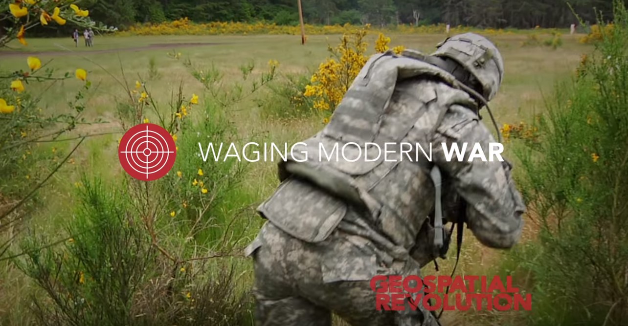
Introduce students to other applications of GIS to understand current events and introduce students to careers related to geospatial technologies. View the following video created by Penn State Public Broadcasting illustrating how the US military uses GIS for both warfare and peaceful missions. Topics in the video include Geospatial technology, US military, mission planning, terrain data, human geography (culture, economics, education)
EXTEND
“What’s next?”
The following example questions may be used for discussion following the module application:
- How does my view of the community impact how I interact with my community?
- What can I do in my community to support others “re-seeing” the neighborhood?
- Where might I go to learn more about technologies that support peoples’ everyday interaction with their neighborhoods?
As a class you might discuss how issues related to re-seeing can be useful in their future beyond the classroom. Further, a discussion regarding how more effective behaviors can develop from the new learning could reinforce the ideas presented in this module. Students may want to investigate either a historical, current event, or school level problem that may be answered using ways of “re-seeing” a location, situation, or event.
Potential Challenge:
How is an understanding of viewsheds important for mitigating crime in the community?
- Students could be assigned a specific place in the community, such as a local park, a parking lot near the mall, a street near the school, or any other suitable location.
- First, they could explore that place virtually via Google Earth or Google Street View in Maps. They can place themselves at that spot virtually and examine the viewshed from all directions around their assigned location. What is their view like in every direction? Are there any obstacles to seeing what lies ahead of them from that place (such as trees, bushes, buildings, and so on)?
- There have been a few studies that suggest that urban parks would be safer if there were fewer obstacles in the way for neighbors and law enforcement to observe what is going on in the parks. For example, the removal of brush or abandoned houses near the park has opened up the view in some cases. Students could be asked to consider what implications there may be for the viewshed from their assigned locations. They could then suggest ways to improve safety in the community.
STUDENT RESOURCES
- Student Resource I - Primary Document Journal Response
- Student Resource II- Exploring Historical Place
- Student Resource III - Battle of Gettysburg Maps
- Student Resource IV - Group work on Gettysburg Maps
- Student Resource V - Re Imagining Gettysburg Video
- Student Resource VI - Defining Viewshed
- Student Resource VII - Zombie Viewshed Activity
Appendix Table
URL |
Purpose |
|
Background Information |
|
Henry Keiser's dairy explaining the Battle of Gettysburg in detail. |
Video |
http://ed.ted.com/lessons/a-digital-reimagining-of-gettysburg-anne-knowles#watch |
A Ted Video introducing students to GIS analysis of viewshed. |
Analysis |
http://ed.ted.com/lessons/a-digital-reimagining-of-gettysburg-anne-knowles#watch |
Interactive map and article by Smithsonian website that can be accessed to understand the concepts of viewshed and Battle better. |
Mapping |
Story map by ESRI |
|
Definition |
Oxford dictionary definition of viewshed |
|
Vocabulary support |
http://support.esri.com/other-resources/gis-dictionary/term/viewshed |
ESRI dictionary to look up GIS terminology |
Comparitive maps |
National geographic website has variety of maps with other viewshed representations |
|
Video |
Penn State video that explains how maps are used in the military |
|
Video |
Penn State video that explains how maps are used in the military |

RESOURCES & REFERENCES
(1863) [Sketch of the battlefield of Gettysburg, July 1st and 2nd, 1863]. [Map] Retrieved from the Library of Congress, https://www.loc.gov/item/2005625069/.
Bachelder, J. B. (1863) Gettysburg battle-field. Battle fought at Gettysburg, Pa., July 1st, 2d & 3d, 1863 by the Federal and Confederate armies, commanded respectively by Genl. G. G. Meade and Genl. Robert E. Lee. Boston and New York: Jno. B. Bachelder. [Map] Retrieved from the Library of Congress, https://www.loc.gov/item/2007630421/.
Google Maps. (2017). The University of Toledo. Retrieved from https://www.google.com/maps/place/The+University+of+Toledo/@41.6592145,-83.6116801,639m/data=!3m1!1e3!4m5!3m4!1s0x883c78ca74eda69f:0xf9c73b0fad95b575!8m2!3d41.6580307!4d-83.6140701
Google Maps. (2017). The University of Toledo Street view. Retrieved from https://www.google.com/maps/@41.6603279,83.6130118,3a,75y,91.03h,93.71t/data=!3m6!1e1!3m4!1scWRw-wwph46D59TQHY3x4g!2e0!7i13312!8i6656!6m1!1e1
Knowles, A. K. (n.d.). A digital reimagining of Gettysburg—Anne Knowles [Video file]. Retrieved from http://ed.ted.com/lessons/a-digital-reimagining-of-gettysburg-anne-knowles#discussion
Knowles, A. K. 2013. A Cutting-Edge Second Look at the Battle of Gettysburg. The Smithsonian. Retrieved from http://www.smithsonianmag.com/history/A-Cutting-Edge-Second-Look-at-the-Battle-of-Gettysburg-1-180947921/?no-ist=
Pennsylvania State University & Penn State Public Broadcasting. (2010). Episode 3: Chapter 2, Waging Modern War. The geospatial revolution. University Park, Pa.: Pennsylvania State University. Retrieved from http://www.youtube.com/watch?v=LifkI7puN9A
Reed, C. W. (1863) Plan of the Gettysburg battle ground. [S.l., Chas. W. Reed, 9th Mass. Battery] [Map] Retrieved from the Library of Congress, https://www.loc.gov/item/99439158/.
Rosen, R.J. (2013) Interactive Gettysburg: Using Modern Mapping Tools for a New Look at the Historical BattleRetrieved from https://www.theatlantic.com/technology/archive/2013/07/interactive-gettysburg-using-modern-mapping-tools-for-a-new-look-at-the-historical-battle/277432/
Sneden, R. K. (1863) Cavalry battle, Gettysburg, Pa. July 3rd 3:30 p.m. [S.l., to 1865] [Map] Retrieved from the Library of Congress, https://www.loc.gov/item/gvhs01.vhs00150/.
Sneden, R. K. & Birney, D. B. (1863) Copy of official plan of Gettysburg. Pennsylvania, fought 1st, 2nd, 3rd July 1863. [to 1865] [Map] Retrieved from the Library of Congress, https://www.loc.gov/item/gvhs01.vhs00291/.
Viewshed (n.d.). English Oxford Living Dictionary. Retrieved through https://en.oxforddictionaries.com/definition/viewshed.
Viewshed (n.d.). Esri, GIS Dictionary. Support: Other Resources. Retrieved through
http://support.esri.com/other-resources/gis-dictionary/term/viewshed
Appendix A: Battle of Gettysburg Maps
(1863) [Sketch of the battlefield of Gettysburg, July 1st and 2nd, 1863]. Retrieved from the Library of Congress, https://www.loc.gov/item/2005625069/.
Bachelder, J. B. (1863) Gettysburg battle-field. Battle fought at Gettysburg, Pa., July 1st, 2d & 3d, 1863 by the Federal and Confederate armies, commanded respectively by Genl. G. G. Meade and Genl. Robert E. Lee. Boston and New York: Jno. B. Bachelder. [Map] Retrieved from the Library of Congress, https://www.loc.gov/item/2007630421/.
Reed, C. W. (1863) Plan of the Gettysburg battle ground. [S.l., Chas. W. Reed, 9th Mass. Battery] [Map] Retrieved from the Library of Congress, https://www.loc.gov/item/99439158/
Sneden, R. K. & Birney, D. B. (1863) Copy of official plan of Gettysburg. Pennsylvania, fought 1st, 2nd, 3rd July 1863. [to 1865] [Map] Retrieved from the Library of Congress, https://www.loc.gov/item/gvhs01.vhs00291
Sneden, R. K. (1863) Cavalry battle, Gettysburg, Pa. July 3rd 3:30 p.m. [S.l., to 1865] [Map] Retrieved from the Library of Congress, https://www.loc.gov/item/gvhs01.vhs00150/ .
Appendix B Primary Document Analysis Support Document
Library of Congress (n.d.). Teacher’s guide analyzing maps. [Illustration.] Retrieved from
http://www.loc.gov/teachers/usingprimarysources/resources/Analyzing_Maps.pdf
Library of Congress (n.d.). Primary source analysis tool [Illustration.] Retrieved from http://www.loc.gov/teachers/usingprimarysources/resources/Primary_Source_Analysis_Tool.pdf
Appendix C: Zombie Viewshed
Scenario:The community you live in has been overrun by Zombies (or Aliens, a foreign invader…etc.), and you need an escape route. Using what you’ve learned about geographic representations, especially the concept of viewshed, identify one “view” from your current location that would provide the best view if you were trying to escape Zombies from your current location. Write one paragraph describing what you would see.
Next, go to the location, take a photo using a digital device and compare with your written description. Was it what you expected? Upload the photo to share with class along with an explanation of why you selected this location based only on what is visible in the photograph. If you do not have a device, use Google Maps, and take a screenshot of the street level view (see example below).
Consider how you would represent the view on a map. Create a map that shows the path and the representation of the “terrain” in your area. Identify the possible view by shading a “triangle” to represent the viewshed. Describe your plan for escape, supporting your decisions with evidence based on your photographs and the map.
Once you have completed the map and other tasks, describe what cannot be seen outside the frame of the photo (beyond the viewshed), either to the right, left, or behind you and why/how this information is important for making an educated guess about the best path to escape the zombies.
Finally, reflect on this activity and describe how it helped you to re-see either the area you were focusing on, or one of your classmate’s paths.
Example 1: Path that I would take to. Example 2: What I can see from where I
escape. (Google Maps, 2017) took the photograph. (Sight is limited by trees, buildings, etc.,) (Google Maps, 2017)
