

ERRL: Current Projects
Recreational Water Quality at Maumee Bay State Park: Sources of Bacteria, Environmental Dynamics, and Treatment Opportunities
Maumee Bay State Park (MBSP), situated on the southwestern shore of Lake Erie near Toledo, is a popular destination for outdoor recreational opportunities. The Park boasts a lakefront resort, a marina, a large campground, a golf course, a nature center, a wetland boardwalk, and public beaches. While the number of visitors accessing certain amenities at the Park has remained steady, there has been a decline in the number of visitors to the beach, most likely due to the number of high bacterial advisories posted. Advisories are posted an average 14 days of the typical 100 day bathing season, and have occurred as many as 50 days in one season. The Lucas County Health Department requires the postings when the counts of the indicator bacterium Escherichia coli (E. coli) have exceeded the state standard. E. coli is a species of bacteria that lives in the intestines of all warm-blooded animals, including humans. The detection of E. coli in the environment indicates fecal contamination and often implies the presence of other pathogens that are potentially harmful to human health. Exposure to high levels of these pathogens can cause an increased risk for ear, nose, and eye infections as well as gastrointestinal and stomach illness.
Source Tracking
In 1995 a coalition of governmental agencies formed the Maumee Bay Bacterial Task
Force with the purpose of working to identify the main sources of bacterial input
to the MBSP waters and review potential remediation strategies.
Members of this team included representatives from the City of Oregon, the City of
Toledo, Toledo/Lucas County Health Department, Ohio Department
of Natural Resources, Ohio Department of Health, Ohio Environmental Protection Agency,
Toledo Metropolitan Council of Governments, and University
of Toledo. Involvement of the ERRL lab began in 2003 when Pam Struffolino
and collaborators in the U.S. Geological Survey launched a project to identify the
sources of bacteria using E. coli as the indicator
organism.
During the 2003 recreational season, twenty-four sample sites were located through out the Maumee River and western Lake Erie to monitor drainage and major inlets to the Maumee Bay area. Samples of water, bottom sediment, and suspended sediment were taken to help evaluate the relationship between water quality variables and densities of E. coli and to identify the main sources of E. coli to Maumee Bay.
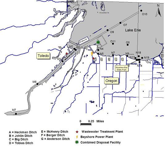 |
| Map of Maumee Bay/Western Lake Erie M designates sites within the Maumee River N designates sites that are near-shore O designates sites that are off-shore |
|
|
|
|
|
|

Near-Shore Sampling and Off-Shore Sampling
At each near-shore site, grab samples of water and
three bottom sediment samples were collected and analyzed for E-coli. At the off-shore
sites, water samples were taken and the bottom sediment
was obtained with a Petit Ponar. Water samples were analyzed using the modified mTec
method and the bottom sediment samples were composited and
analyzed with the Colilert method. Temperature, specific conductivity, pH, and dissolved
oxygen were also measured using a
Hydrolab.
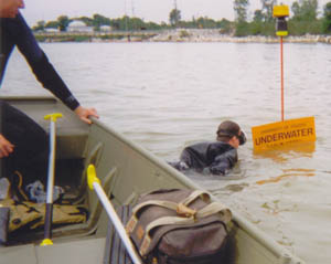
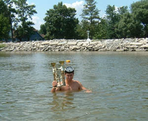
Sediment Traps
Specialized sediment traps were designed for
collection of suspended sediment. The traps consisted of a set of five graduated cylinders
surrounding a circular base. The sediment
traps were anchored at the mouths of several small rivers draining into the Maumee
River and at the mouths of ditches discharging into the Maumee
Bay area. The traps were allowed to accumulate sediment and were emptied and replaced
every 1-2 weeks. Each time a trap was
pulled for analysis, a water sample and three bottom sediment samples were collected
and composited in the lab. Bottom sediment and trap samples
were collected and processed using the Colilert method. Water samples were processed
using the modified mTEC method.
This study found that Berger Ditch, just to the east of the Maumee Bay State Park
beach, is a principal contributor of fecal
contamination to the recreational beach. To view the full
report, click here.
Environmental Dynamics
Following up on the 2003 study, a U.S. Geological Survey stream gage with automatic
sampler and
acoustic Doppler velocity meter (ADVM) was installed on Berger Ditch in 2006 to better
understand the hydrology of the ditch and its influence on
E. coli densities at the MBSP beach. The system was installed approximately 1.2 km upstream
from the discharge of Berger
Ditch into the MBSP marina. Samples were set to be collected when there was a change
in streamflow of 8 ft³/sec and when streamflow
either exceeded 15 ft³/sec or decreased below -15 ft³/sec. This setting allowed for
observance of negative flow conditions within the
Ditch, which are caused by northern winds or the Lake Erie seiche effect. Real-time
streamflow was posted on the USGS website, and the
collected water samples were analyzed by Colin de Saint Victor for
turbidity, suspended solids, and E. coli densities.
To view the 2006 USGS Open File Report relating to this study, click here.
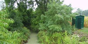
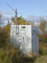 |
Left: Berger Ditch gage house, installed in 2006 |
In 2008, a second stream gage station equipped with an automatic sampler and ADVM was installed further upstream within Wolf Creek (which becomes Berger Ditch). Steve Choc has continued the monitoring of E.coli, suspended sediments, turbidity, as well as phosphorus levels and the effects of seiche events at these two stations. Preliminary analyses have shown that densities of E. coli vary seasonally and with storm events. Within storm events, densities of E. coli correlate with suspended sediment masses. Data from these studies were incorporated into a model for the design of a passive treatment system.
To view the 2007 USGS Open File Report relating to this study, click here.
Treatment Opportunities
Constructed wetlands have been utilized across the world for the
treatment of pathogens. These types of wetlands mimic the ability of natural wetlands
to act as filters, removing sediments and associated
pathogens. Our consulting partner, Hull and Associates, Inc. was tasked with determining the
feasibility of constructed wetland placement, as well as developing a model for determining
design constraints such as sizing, retention size,
etc. Their initial reports and findings can be found below.
Wetlands Feasibility Reports, from Hull and Associates, Inc.
Summary of Investigations in Maumee
Bay State Park
Subsurface Constructed Wetland Engineering
Fluvial Morphology of Wolf Creek and
Berger Ditch
Berger Ditch Watershed Hydrologic Modeling and Maumee Bay Hydrodynamic Modeling
For further information on the Maumee Bay Bacterial Task Force or this multi-year project, visit www.tmacog.org/Environment/Maumee_Bay_wetland.htm.